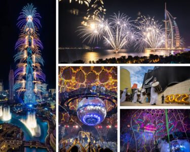
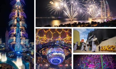


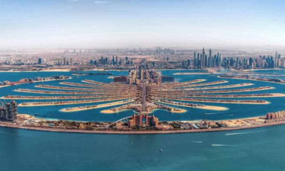


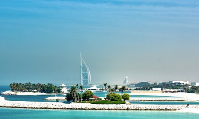


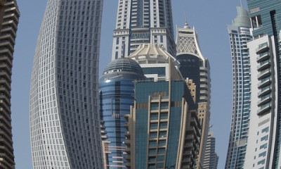


When you are the fourth most visited destination in the world, with 16 million incoming tourists in 2019, a system to map the city and its various attractions and facilities for tourists and visitors is a necessity.
Dubai’s pro-active and tech-savvy approach has created the foundation for Dubai to be mapped, video-graphed and have all its spatial information easily accessed, at the, as you know it, click of a button.
Dubai’s Geographic Information System (GIS) centre was set up in early 2001 with a mandate to act as the sole authority to distribute geographic data.
The GIS is available at the core of a visitor’s Dubai experience, not just when they get here, but when they are at home, anywhere in the world, planning their trip to Dubai.
The sole source of government mapping services in Dubai, the GIS Centre has continually updated its spatial databases. The centre has a system that creates, manages, analyses and maps all types of data to create better-exploring experiences for tourists – providing updated data for road networks and facilities like parks, beaches, shopping centres, historical and natural sites.
“Our vision is to make spatial data a public utility and serve accurate and up-to-date data to facilitate real-time mapping and decision-making,” a Dubai GIS centre statement said in 2010.
GIS applications, the tourist’s view
GIS apps help provide a superior tourist experience. Near accurate details of an area tourists wish to visit can help them understand the culture and values of the residents. For tourism officials, social media platforms are powerful tools to have a lasting impact on visitors. Tech advancements like a 360-degree-viewing experience have revolutionised the tourism industry.
The GIS provides information on tourist attractions, geographical conditions, transportation and accommodation
The GIS provides information on tourist attractions, geographical conditions, transportation and accommodation. It produces thematic maps which help tourists understand their destination in a better and detailed manner. Tour operators are vital to the destination value chain and in most cases manages the majority of the experiences that visitors undertake. Tourists can now rely on maps and other GIS-related material to find their way around the world. This technology has been used to create Personality Atlas, Tourist Maps, Subways Map; Linear Referencing; Off-Beaten Tracks; Sustainable Tourism Planning; Hotel Search; Horizon Blockage; Travel Mode Detection; Time Zones, Virtual Travel and Geo-tagging.
Dubai Here app
Dubai Here app is an electronic system that works via a web browser or portable smart devices and includes 2D and 3D maps containing all assets, landmarks, infrastructure, buildings, units, service networks, economic activity information, environmental, health and population information.
This application falls within the Dubai Digital Twin Initiative framework – a digital replica of Dubai that provides all information for planning and managing the city and providing smart services effectively.
Makani
Makani, a geospatial addressing system as an extension of the addressing system currently in use. It allows the addressing of units inside the buildings and the possibility of inferring the building, floor and unit, through an innovative, simplified, non-repetitive code, electronically linked to the addressing system.
With the launch of the addressing system, a panel is fixed to each building unit in Dubai and linked to all essential service providers.
This contributed to simplifying the addressing system and facilitating the process of accessing the units, especially in emergencies and crises.
The 5-minute Affection Plan Initiative
The 5-minute Affection Plan Initiative is in line with the Dubai Paperless Strategy 2021 and comes as joint efforts between the GIS Centre and Dubai Municipality’s Survey Department to develop the process of issuing an Affection Plan and the related geographic systems and applications.
Indoor Roaming in Buildings
Another service is the Indoor Roaming in Buildings. This project consists of a 3D mapping system that provides maps of buildings and facilities with external and internal details, including maps that outline the details of real estate units, the distribution of rooms, while linking the maps to the data and systems related to asset management, maintenance, leasing, safety, civil defence and others.
It also makes available government assets data and the development of a lexicon application for its data through unifying a model and geospatial databases and through conducting a comprehensive field survey of assets.
Databases are then integrated with the infrastructure network data, thus enabling the GIS Centre to support all partners and decision-makers in this regard.
The Drone project
The Drone project provides an integrated system for accurate aerial photography using a drone. It enables the elaboration of accurate maps of areas, facilities and projects, with the aim of immediately and constantly updating the Dubai integrated and standardised base map and the 3D Digital Twin.
Geospatial Car project
The Geospatial Car project provides an integrated solution system to collect geospatial data using road maps technology. The system uses laser and photography devices installed on top of a car for 3D mapping.
The system consists of a high-precision laser scanner, GPS positioning devices and several 360-degree panoramic digital photography cameras.
The Dubai Municipality is the first governmental department in the Emirate to deploy such a system. The system is considered one of the most important technologies for producing the Digital Twin with high speed and efficiency. It also provides 3D data used in all updates for all types of data, especially assets and buildings, in addition to innovative processes to
GIS Dubai, imbed ‘live’
Dubai adopted a public utilities style system for providing a spatial data service in which any individual or organization in the world can imbed ‘live’, interactive mapping and basic GIS services for Dubai into their very own applications without the need to communicate with it and request permission.
To accomplish this, URLs can be easily generated within the Dubai GIS that can be embedded into an application allowing the user to employ Dubai’s GIS capabilities.
Building Information Modelling
Today, the Dubai Municipality has several GIS projects under its belt, including the Building Information Modelling (BIM) whose capabilities includes an automatic design audit and the development of a mechanism to send forms and data to the geospatial database for updating the base map.
The civic body’s Building Permits department uses an electronic system that allows automatic verification of plans, smart inspection and integration with geospatial information systems.
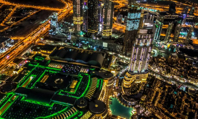
In Dubai, it will all be 3D
In June 2021, the GIS Centre Dubai developed an integrated system for classifying Dubai assets in a comprehensive geospatial dictionary in line with the vision to transform the Dubai government into a fully smart model.
It aims to develop the traditional image of base maps to include all assets created on the ground in a 3D digital twin manner that includes all government assets with a fixed spatial dimension. The system contains a search engine that helps the user to access any item or detailed data available within the centre and available automatically in the system.
A new, ambitious project conceived by the GIS Centre operated by Dubai Municipality will make it easier for tourists to plan their tours
According to reports, an ambitious project has been conceived and is in progress by the GIS Centre operated by Dubai Municipality. The new project will make it easier for tourists to plan their tours. The advanced aerial photography project is being implemented by using specialised survey aircraft.
The pan-Dubai project that includes the mountainous Hatta bordering Oman, is in line with an ambitious project seeking to transform the emirate into one of the world’s leading smart cities.
A twin-propeller GeoDubai two-seat aircraft has been equipped with hi-Res cameras of 150 megapixels to carry out aerial photography with an impressive accuracy of 10 centimetres.
The ultra-high-resolution cameras have a backside-illuminated sensor to enhance image quality even in low light conditions. The cameras are designed to fit one of the seven interchangeable RS lenses, ranging between 32 and 150 millimetres. The iXM-RS150F and iXM-RS100F cameras provide the option to film several areas of Dubai in a day. The project will generate a twin 3D geospatial model to update the base map and inventory of the assets of government agencies in Dubai.
It is part of the broader mandate of the GIS Centre to collect aerial photographs and geographic data for the emirate. The project would undergo several lifecycles. Initially, it is being linked to ground control points via the GPS. In the second step, the route and the altitude that the pilot follows will be determined. Aerial photography is the third step by using state-of-the-art digital cameras. Finally, the images and data will be collated and analysed by applying advanced technology.

Be the first to write a comment.
Your feedback